6/30/17: Seiad Valley to Buckhorn Spring

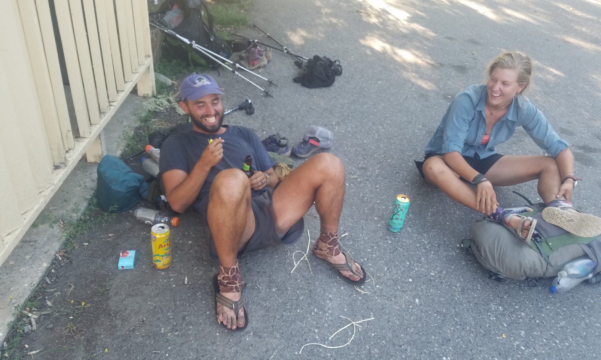
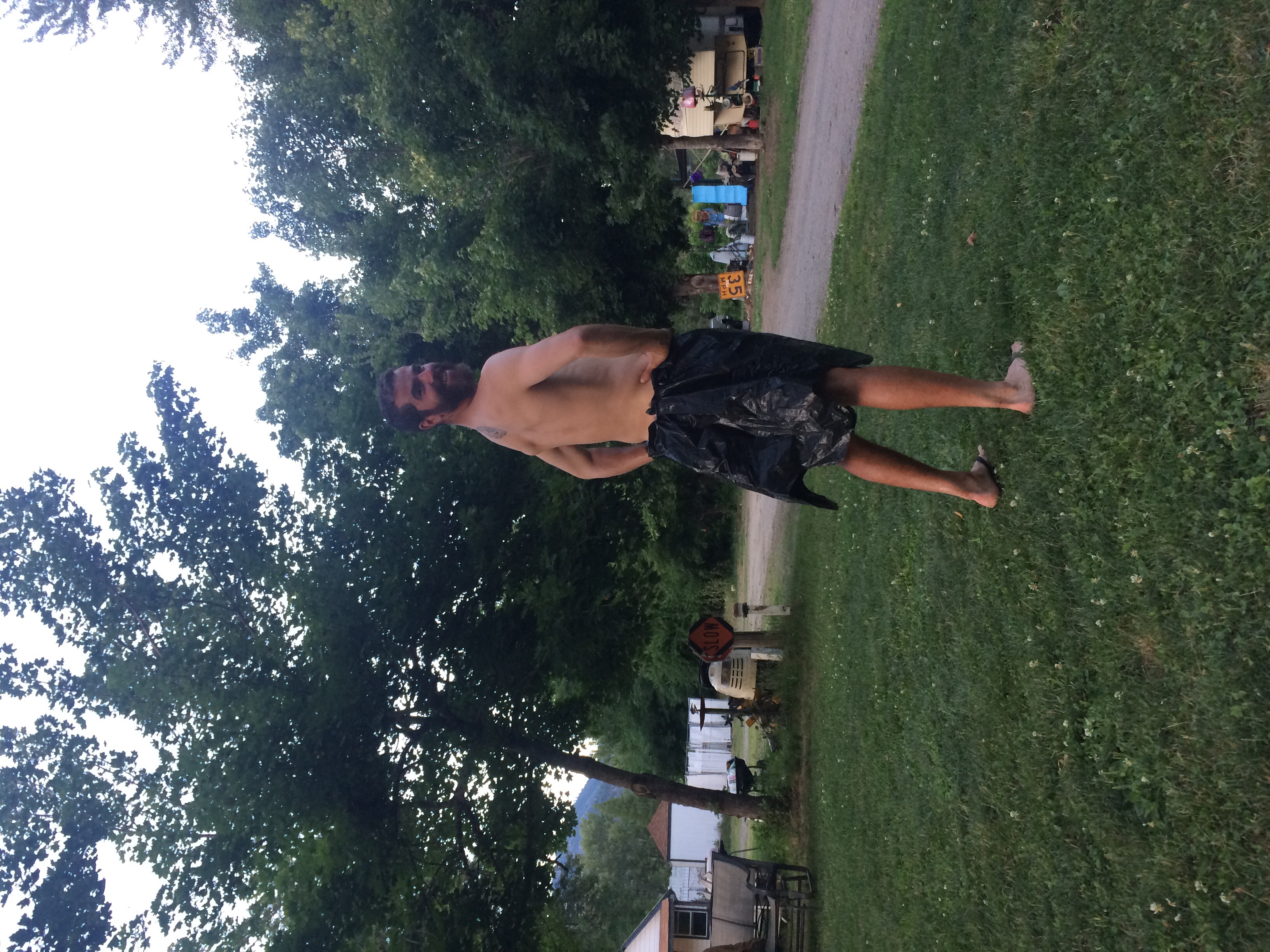
We got to sleep in today because we planned to go to breakfast at the Seiad Valley Cafe, which opened at 7 AM. Wolf Bird’s favorite meal to go to a restauarant for is breakfast, while I prefer to go out for lunch or dinner foods. Luckily we got the best of both worlds as they allowed me to get a sandwich off the lunch menu! Our meals were super tasty and we ate so much we felt very full.

We packed up our stuff and finally got hiking around 930 or so. The first 6 or 7 miles of the day was all road walking. I guess it’s all private land around here so the PCTA hasn’t been able to secure land to create a trail on. The road walk was hot and felt neverending. It changed from paved roads to a dirt forest service road after a while. Eventually a forest service truck pulling a horse trailer passed us and a older man dressed in all denim with a cowboy hat got out. He chatted with us about the trail and about his horses. Well actually there were two mules (huge ones, as they’d been bred from draft horses) and one horse. He was quite talkative while his younger volunteer Marissa just stood there silently. They were going to do some trail work and told us we may see them later today.
We said goodbye to our new friends and finally reached the part where the actual trail resumed. We passed an established campground that is temporarily closed from a forest fire last year. Not long after Wolf Bird spotted a black bear off to the left of the trail in the woods! I only got a quick peek at it as it walked away from us but it was huge! We guessed that it must have used to have raided the now closed campground.
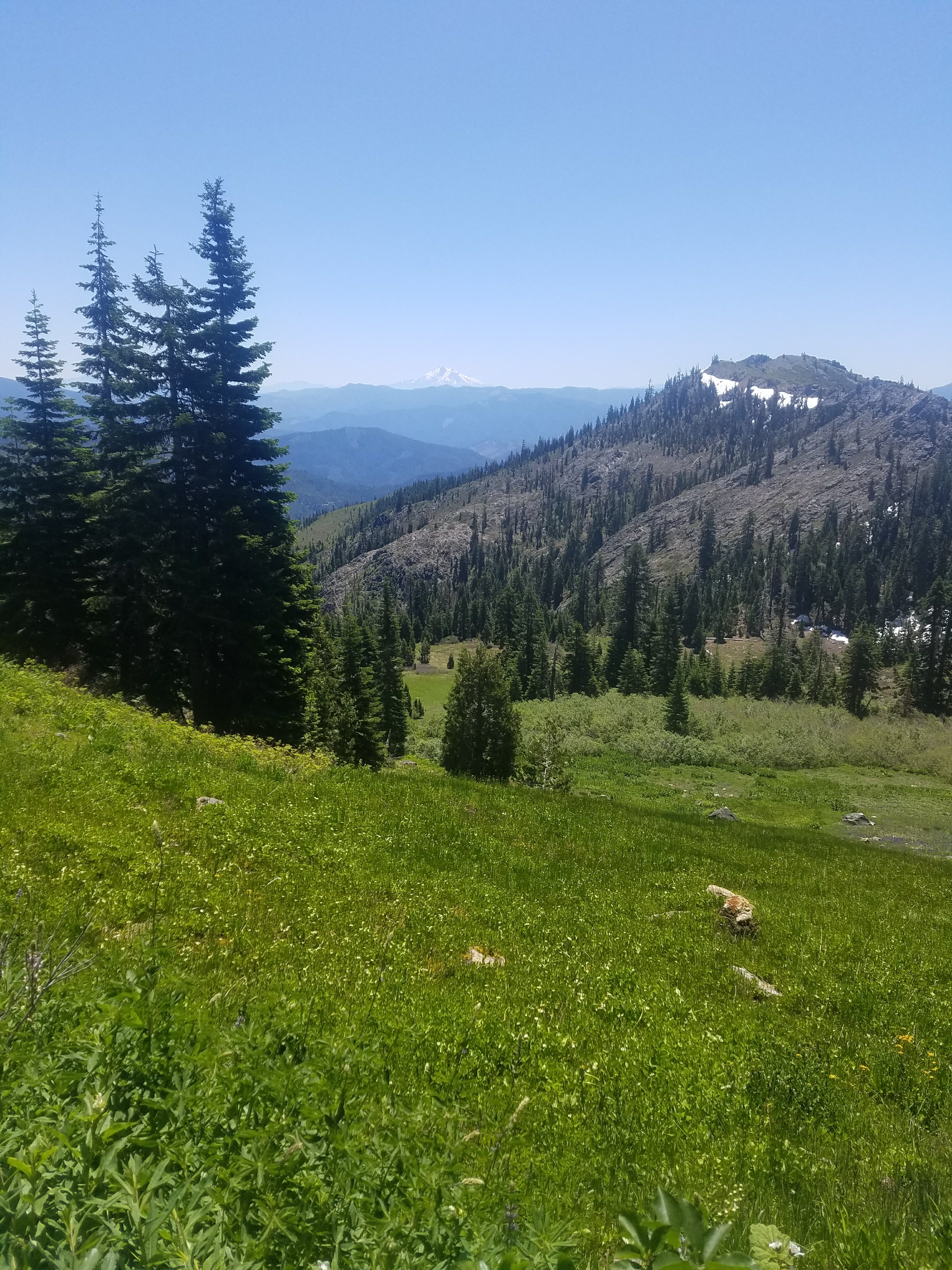
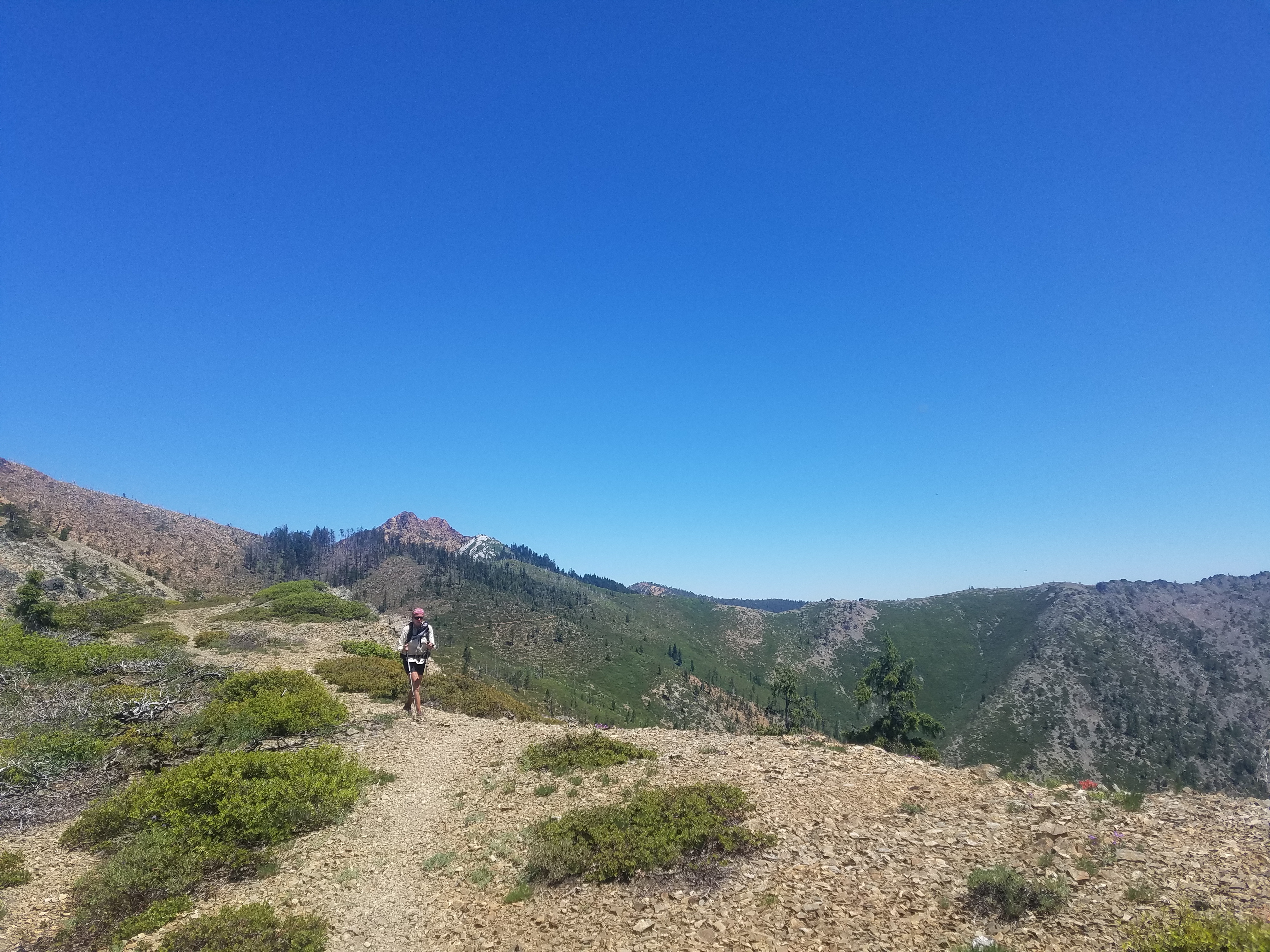
Our entire day was to be uphill, as sections out of town typically are. The walking wasn’t too difficult and we passed a bunch of other thru hikers heading north. All of them must’ve skipped the Sierra and resumed the trail somewhere north of them. It’s funny because even though we are doing the same thing as these northbounders (that is, thru hiking) we don’t really stop and talk to them. Just a quick hello and pass each other.
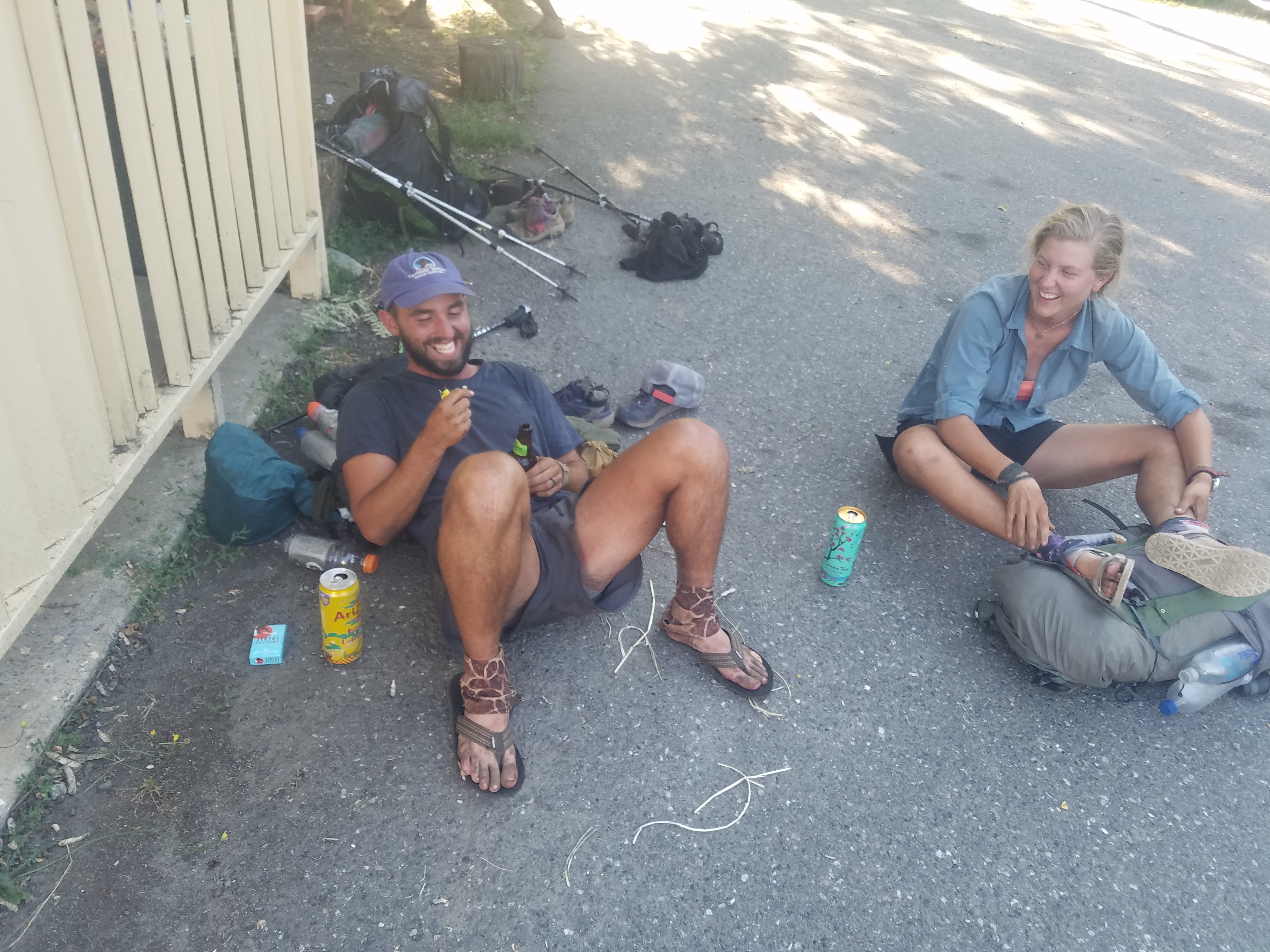
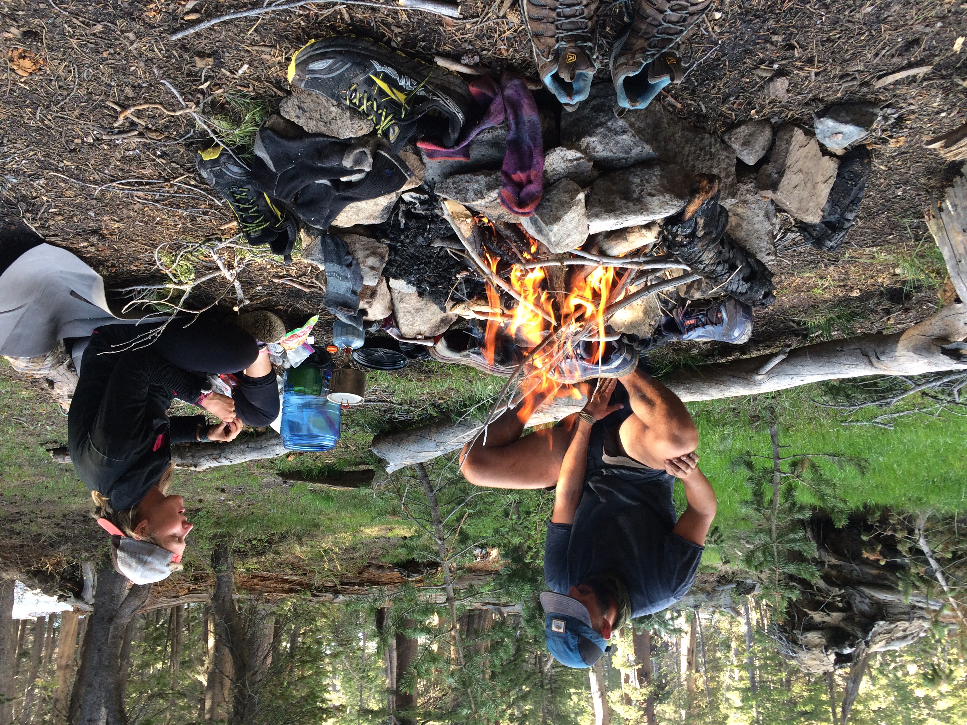
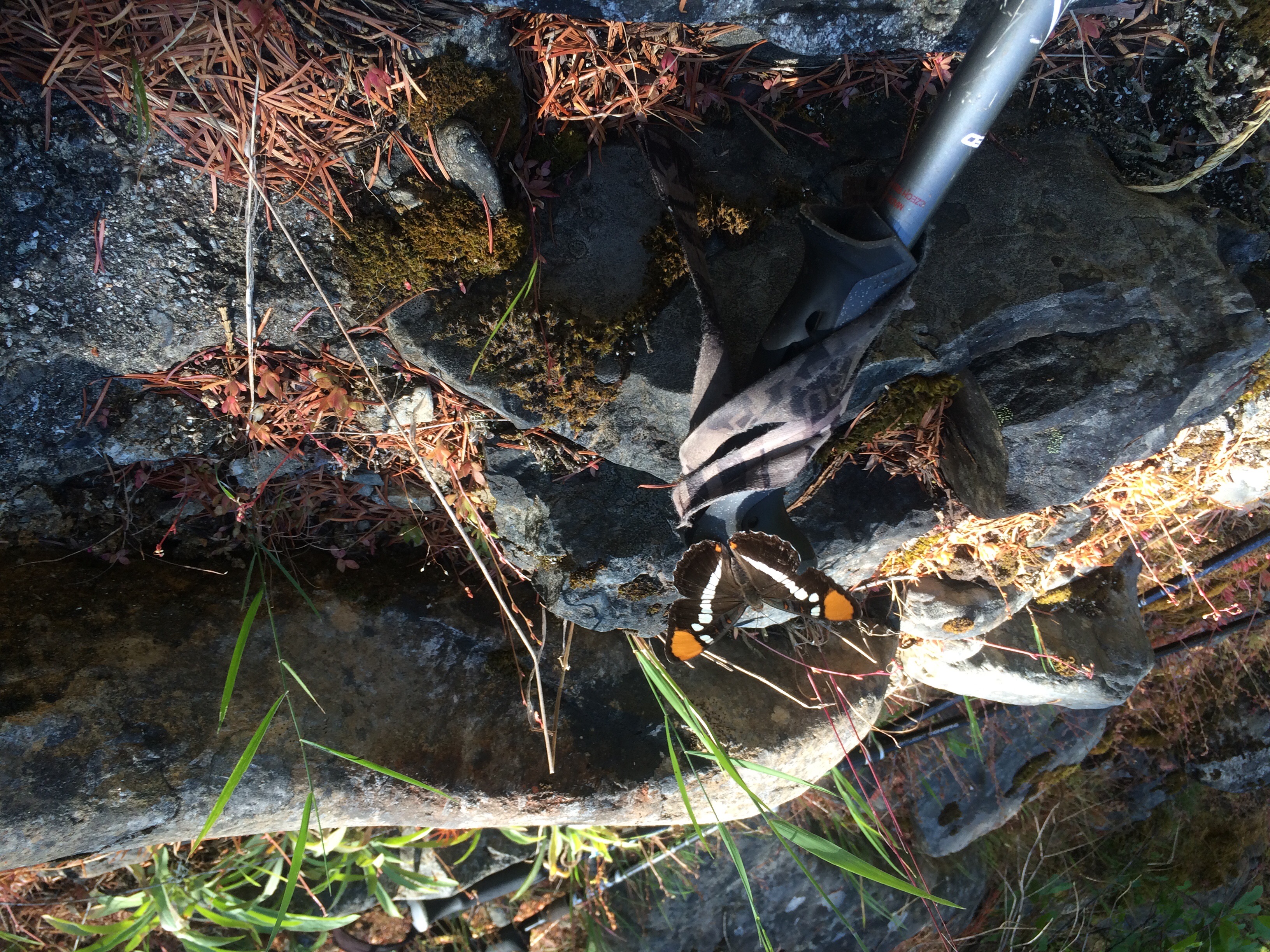
We were really feeling the miles today and felt like we were just dragging. We passed Yote and 2.Toe who were hanging out in the shade under a bridge over Grider Creek which we were following all day. We had the same idea and planned to stop at a bridge a few miles up. It was a much needed break. I soaked my feet and Wolf Bird of course went all the way in the freezing water. We ate and relaxed in the shade by the creek. There have been a ton of butterflies in this section and during this break at least four landed on my hiking poles! It was so cool and beautiful to see them and I was able to get a couple photos and a video.

?
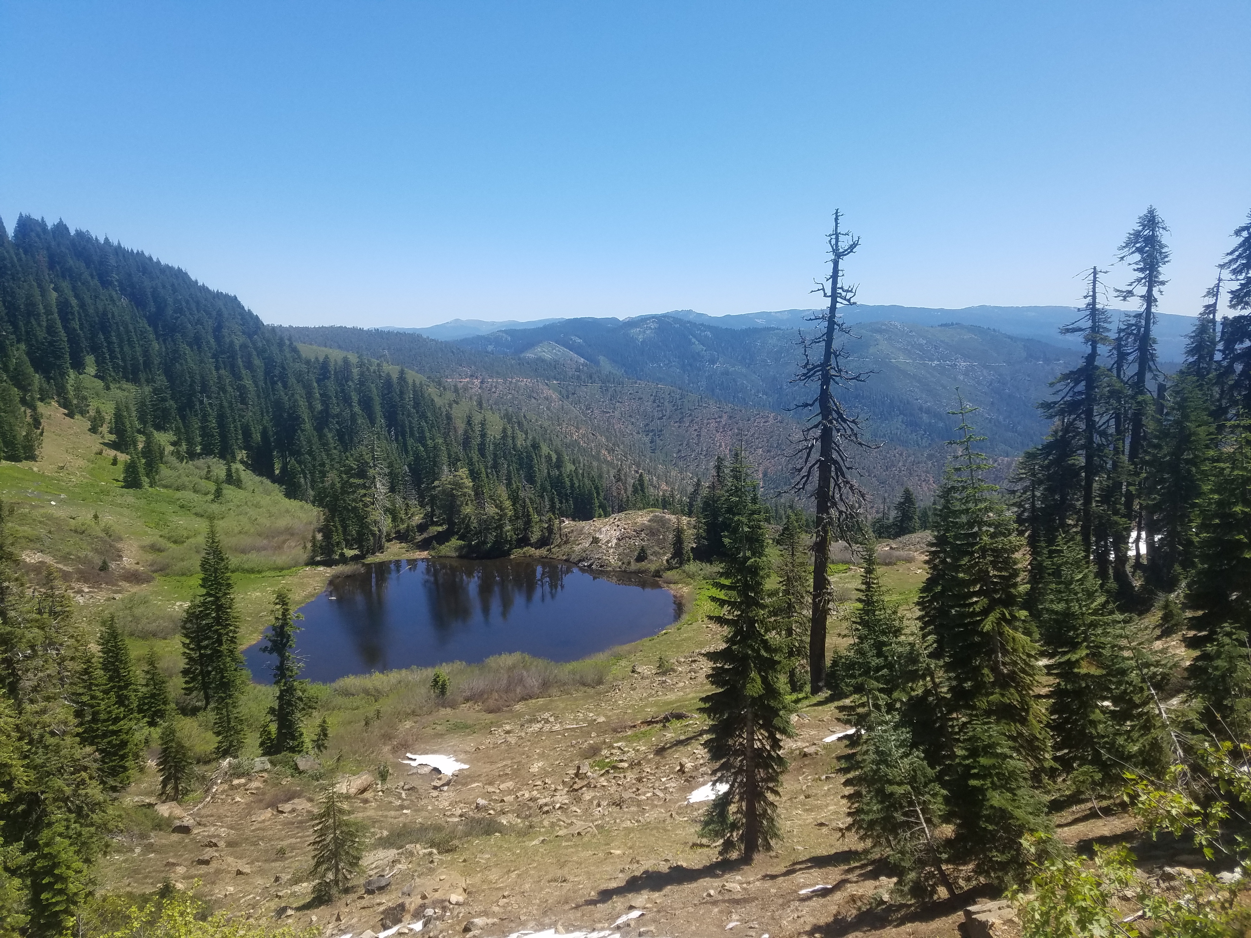
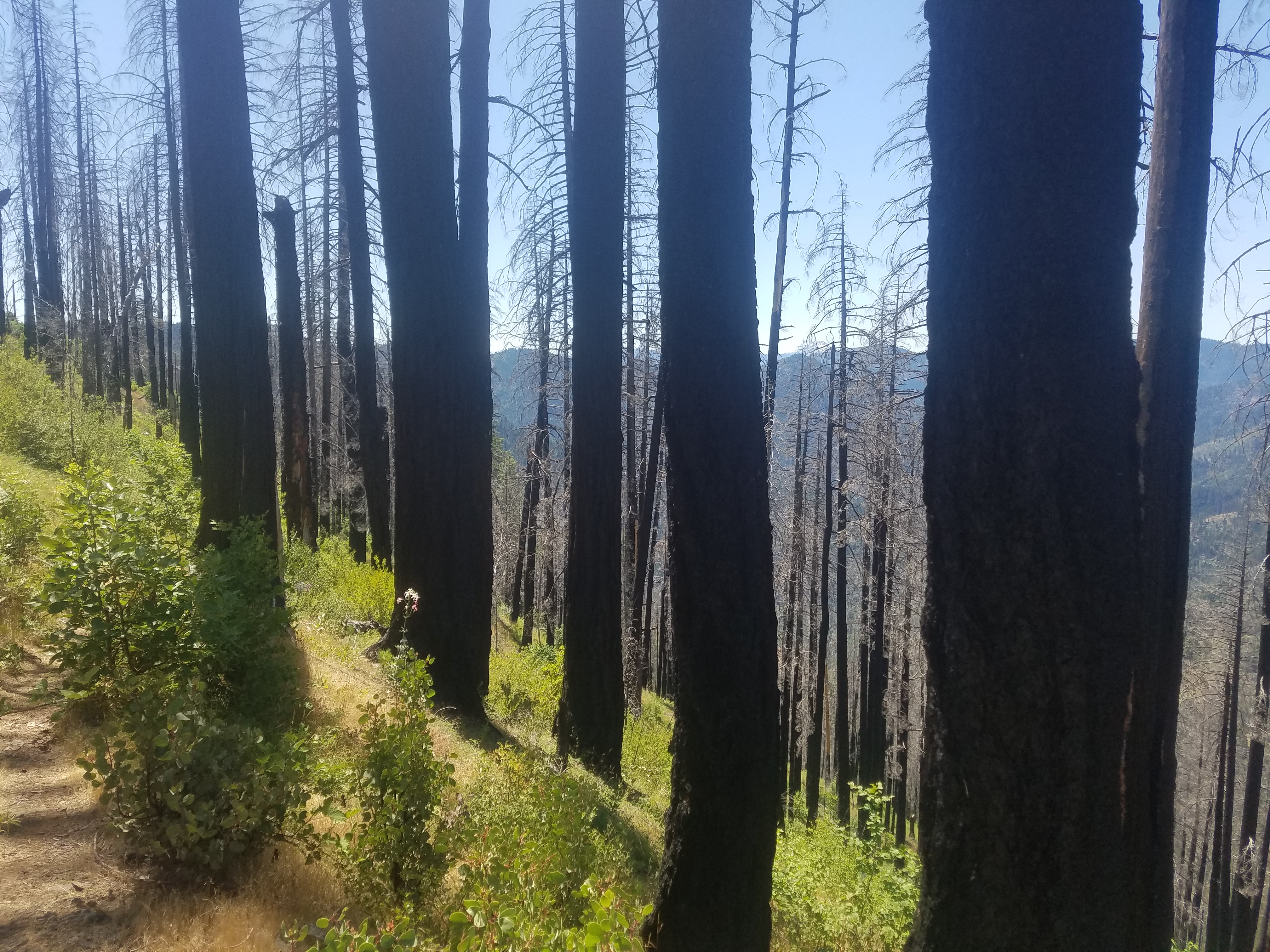
After our break we had 8 more miles until our campsite for the day. Again we were dragging although eating definitely helped give us some energy. This section is a recovering burn area and the actual trail was super overgrown and I grew very frustrated with all the brush scratching my legs nonstop. After an hour or so all of a sudden we rounded a corner to see a giant mule in the trail! Along with our cowboy forest service friend from earlier. He yelled hello to us and even remembered our names–his was Bill Roberts. He chatted with us for quite a while. He is a man with many stories, most involving his horses or mules. He also apparently has written a poetry book and offered to recite a poem for us. We of course said okay and as he was on maybe the third or fourth line (and reciting with much excitement) his mule let out a huge slow fart. It was a giant expulsion of air with a prolonged whoosh noise. Better yet the mule’s butt was right next to where Bill was standing so it perfectly interrupted his poem. We all laughed and he eventually restarted the poem… But man did Wolf Bird and I have a good laugh about that fart later in the tent that night! How well timed.
Bill was an interesting man and it was nice to talk to him… But alas we had more miles to go. Just as we were leaving, Yote and 2.Toe caught up and enjoyed seeing the mules as well. We finally got on the road and realized we Must’ve talked with Bill for nearly an hour!! Jeeze! We still had five miles to go and they were quite the slog. All uphill in the hot sun. I threw in my headphones and listened to a podcast Crimetown to help the time go by quicker.

I ran out of water on this section (just poor planning on my part) and got soo thirsty. I had trouble thinking about anything but how thirsty I was. Finally I passed a small stream that had super cold water and just chugged a liter without treating the water I was so thirsty.
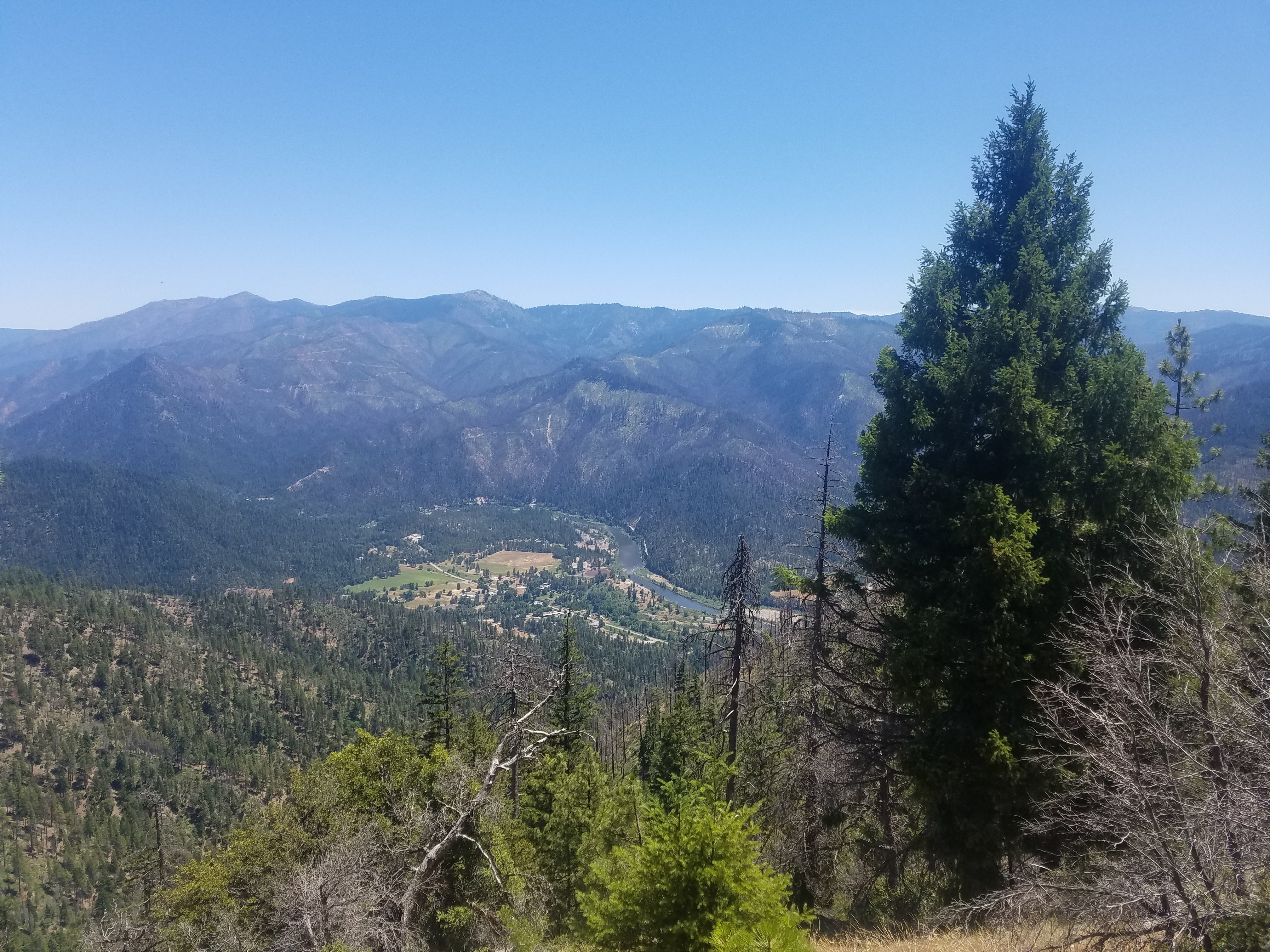
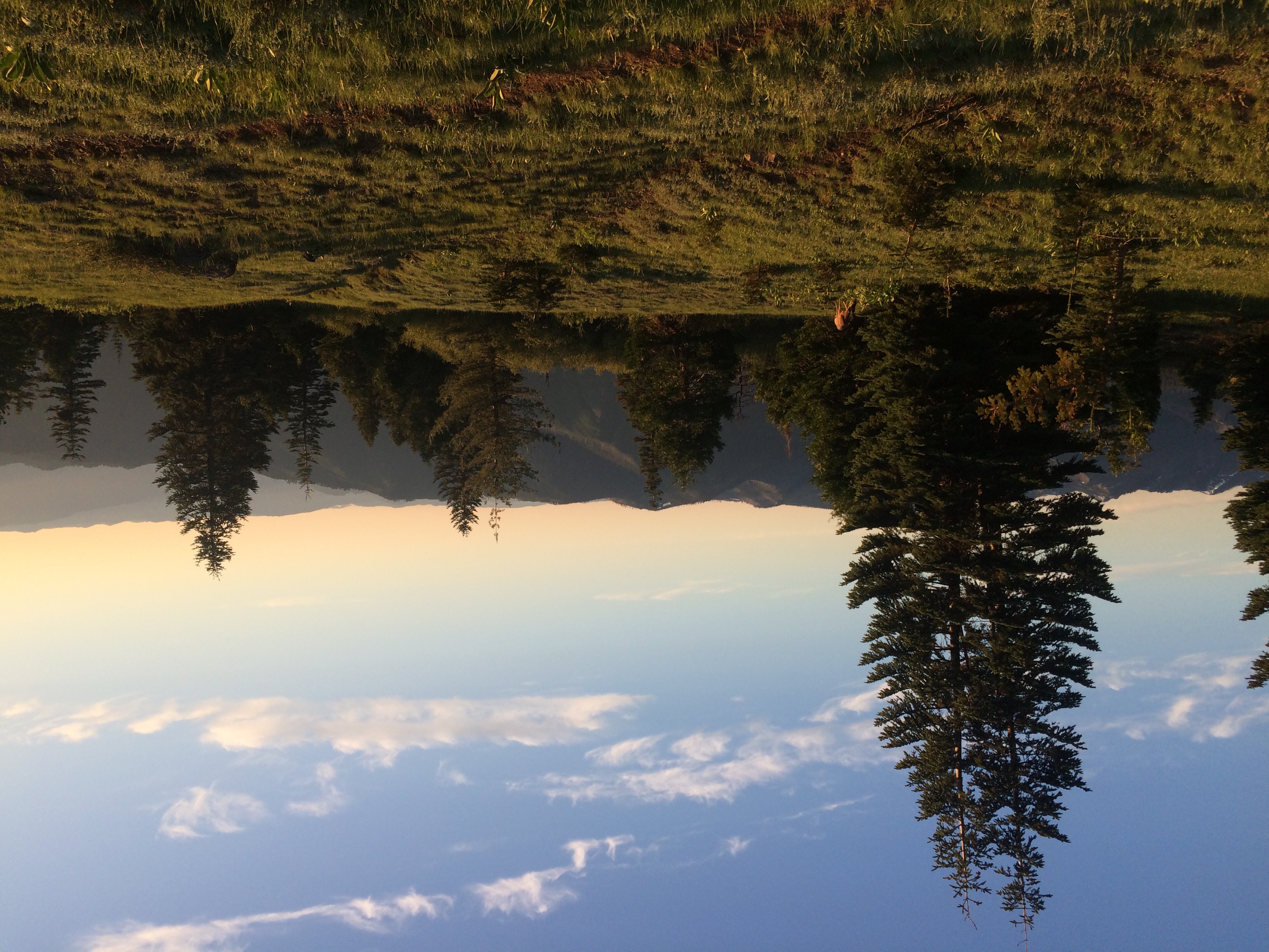
We arrived at our campsite by a spring soon after. A Canadian couple also going south in the same flip flop pattern was there. We chatted with them and later a girl Flame showed up who is also going South. Then Yote and 2.Toe arrived and we all chatted and set up camp. As I was taking a photo of the view I noticed a deer right near our camp! It appeared to be limping and also did not run away once it noticed me. It stood eating a plant and let me get pretty close to take photos. 2.toe later said it was wandering around near their tent all night! It was so cute and a treat to get to watch up close.


We went to bed and slept very well even with a sloped campsite.

6/29/2017 Stealth Site 1678.0 to Seiad Valley 1653.4

Not a lot to say about today, mainly because I am having trouble remembering what we did.  I do remember the hike went quickly, though painfully, and it was very beautiful even though we belted out 24.6 miles. We were in Seiad Valley by 4:30 p.m. and immediately began consuming as many different beverages as we could get our hands on at the general store. I got a chocolate milk, Bai, Coors Light, Sobe, and a coke. I was so dehyadrated after walking 4 miles or more dry.  Soon after 2.Toe and Yote showed up and they said they had a tough day with a lot of foot pain. 

We all headed over to the campground and set up for the night for $15 a head which was a bit expensive for us but it was really the only option for the next 8 miles. We all enjoyed the showers and I did laundry for the group and soon we were all in bed and sleeping like little hiker babies. 

6/28/17: Grouse Gap Shelter to Mile 1677(ish)

It was hard getting up this morning as it was chilly out and we were warm and comfy in our sleeping bags. But alas we had miles to walk. We left the shelter and had to walk by the cows we saw yesterday, which I’m of course afraid of due to my cow incident on the AT. I made Wolf Bird act as my buffer and shield from the cows and luckily survived without them even really looking at me. 

The morning really flew by today! There was a section with a fair amount of snow but Wolf Bird and I opted to go off trail and walk downhill below the snow, paralleling the trail for a bit. This was easier than walking on the snow and before we knew it we were past the snow. We leapfrogged a bit with a guy whose name I don’t know but will call Angry British Guy. He is my trail enemy. Well not really but back in Bishop we did get into sort of an argument. A bunch of hikers were sitting around chatting (including him) and somehow Inchworm came up. She was an AT hiker in her 60s in 2013 who went missing in Maine on her thru hike and later was found dead in her tent less than a mile off trail. Wolf Bird and I had met her the day before she went missing and always found this story so especially sad because of how nice she was and how competent she seemed. Anyway people were talking about her and Angry British Guy (ABG) kept trying to contribute to the conversation but with incorrect facts. He was like “oh yeah wasn’t that in 2015” and the guy he was talking to was like “no, 2013” and ABG sort of denied it and made it seem like he still thought it was 2015. He also thought it happened in Virginia not Maine and acted like the other guy was wrong when he stated it was Maine. I wasn’t participating in their conversation but only listening and slightly amused at how people sometimes try to act like experts on something they know very little about. But then ABG went on a rant about how Inchworm was so incompetent and did everything wrong and didn’t know what she was doing. This really crossed the line for me and I couldn’t just stay silent. I felt he was being extremely disrespectful talking poorly about her when he’d already demonstrated he didn’t know the basic facts surrounding her situation. I thought it was even worse to talk bad about someone that has passed away in a tragic situation when we couldnt possibly know her exact circumstances. So I spoke up and said something to the effect of “inchworm was just as competent as any other hiker on the AT or this trail. I don’t appreciate the way you’re talking about her” and he replied asking if I knew her and that he’d heard she got lost all the time and how can you even get lost on the AT. I told him I felt it’d be very easy to lose the trail or get turned around especially in such a rugged part of Maine and he of course disagreed. I could tell we wouldn’t agree on anything so I then just asked him if he would stop talking about it because I felt he was being disrespectful. He then argued he wasn’t being disrespectful. I didn’t want to argue so I was just like ok, fine, will you please stop talking about it regardless. Finally he did and it was sort of awkward for a while but I’m glad I spoke up.  Anyway since then I was not a fan of ABG and was absolutely shocked when he also flipped like us. He’d been bragging about how light his pack was for the next section of the Sierra! I guess he changed his mind. 

Anyway so we were around him a fair amount yesterday and today and he was not friendly (maybe he also dislikes me). It was just awkward as he didn’t greet us when we walked by as is normal etiquette especially when we greet him, and he gives off a very stressed and negative vibe. I am happy to say we did a 26 mile day today and lost him! At least for now. Ok rant over!

We passed the California/Oregon border today and actually took a lunch break at it. It was weird because we didn’t actually walk all of California yet so it wasn’t an exciting moment as it would’ve been walking north all the way to this point. Oh well, one of the downsides of flipping I guess. 


We waited for Yote and 2.Toe for an hour and a half at the border but they didn’t show. We wrote a note to them in the register that we planned to go about 12 more miles today and hiked on. 

The afternoon passed quickly. There was more snow but we were able to walk pretty quickly through it by opting to follow a forest service road that parallels the trail. This allowed us to avoid difficulties in navigation, as it was obvious where the road went even when it was covered in snow. Not so much for the trail. 

We decided to stop a mile shy of our intended campsite as it was growing late and we found a nice area with a good view. We weren’t sure if the other two would Come along or not. I was brushing my teeth just before bed when I spotted them down below the trail on the forest service road! I was glad for the coincidence because if we’d been in our tent I don’t think they couldve seen it from where they were. We chatted with them briefly before bed and got a good nights rest. 

6/27/2017 Ashland 1716.2 to Shelter 1705.7 (Southbound)

Back on the trail today! We are so excited to be hiking again after such a tough decision to flip. The longer we go after the decision, the better I feel about it. 

We woke up in the campground around 7 and sorted through our supplies to see what we needed to get in Ashland. Our next plan stop was Etna, about 100 miles away so we thought we needed roughly 4-6 days of food. I planned on doing a light 5 with a backup dinner. We weren’t confident that we could do big miles because we heard there was potentially a decent amount of snow still hanging around in the next stretch.  

We finished packing everything up and the four of us hit the road. We hit up the grocery store and then split up because Sherpa and I had more chores to do. First we went to the UPS store and shipped all but our essential winter gear back, including our ice axes. We kept our microspikes and I kept my glove liners but everything else went back. Next we went to the post office and Sherpa bounced a package ahead. 

With our chores finished we went to find Yote and 2.Toe. We parked our car in front of a music shop and we heard lovely flute music coming out of it. When we entered we realized it was Yote! Belting out some sweet licks on a wooden flute. Classic Yote, always with the surprises. 

The music shop was amazing and the staff were so welcoming.  They were very eager to let you try the instruments and they had a lot of beautiful, unique pieces. We stayed there for a few minutes and then hit the road to return the rental car. 

We dropped off the car at the Medford airport and then walked to the main road nearby to hitch to the trailhead. Within just a few minutes a guy pulled over and offered us a ride to Ashland. We hopped in and he took off. He told us his name was Jason and it was his first time picking up hitchhikers. He works for a audio book producer in Ashland and recommended A Boy With A Coocoo Clock Heart. He said it was a classic and shouldn’t be missed.  

He dropped us off at the Ashland exit and we started our second hitch. Soon we were picked up by a Trail Angel named Colin. He said he loved hikers and was always finding ways to help when he could and knew right where to drop us off.

He took our picture at the trailhead and we said goodbye then hit the trail. It was so gorgeous and green. It reminds me of hiking on the east coast and it felt great to be in trees and not desert.  

There was nothing too exceptional to report on the hike since it was only about 11 miles and mostly in trees except that it was lovely and over quickly. When we arrived at our goal our way was blocked by a heard of cattle. There were a couple bulls right in our path that seemed determined not to move so we went around. Sherpa is terrified of cows because she was chased by one on the AT. We got around without any issues. Later however, after 2.Toe and Yote showed up, I saw what looked like a mountain lion attacking a bull. Then I saw the bull charge the animal. Yote said it was a dog and then I realized he was right.  Everything looks like a mountain lion to me out here. The cattle gathered in a group and charged the dog. Yote saw the bull lift it into the air with its horns. We were really unsure what to do, if anything until we heard the dogs owner yelling “Trigger leave it.” We saw that he was a hiker and I felt I had to do something to help so I started heading towards the chaos and Yote was right behind me. I am not sure what I was going to do, maybe attempt my hearding skills, of which I have none. Luckily the hiker was able to separate his dog and he hiked on. 

It was a pretty terrifying seen for the dog and I am sure it needed medical attention. There was a truck nearby that took off a few minutes later so maybe it helped the hiker. We will never know what happened to Trigger. 

We, however, went to bed and slept like little hiker babies. 

6/25/2017 Bishop Zero

Today was an important moment on our adventure. We spent the day in Bishop while we decided if we wanted to continue in the Sierra while the stream crossings are so difficult or flip up to Ashland, Oregon and hike south to give the streams time to improve. Finish the Sierra a couple weeks later then return to Ashland to hike north to the terminus. 

It’s a tough mental decision because we want to push through in one direction but Sherpa in particular has really not enjoyed being terrified at every major stream crossing and because of the heat, they seem to be getting worse. We also feel confident that we could do it without major incident so it is purely an aesthetic choice. 

After great pastry in the morning at Schats Bakery and an amazing burger at the brewery, we decided that we would flip. Yote and 2.Toe are also flipping so we will all figure out a plan together for cost sake. We are really excited about heading southbound, the Right way! 

At the moment it looks like hitching to Reno and then renting a car from the airport seems like our best option. 

Wish us luck!

6/23/2017 Tentsite 787.1 to Lone Pine via Kearsarge Pass 789.1

Today we planned to pick up our resupply in Independence before the post office closes at 4. In order to do that we needed to hike roughly 10 miles over Kearsarge Pass. It was the scariest day on the trail to date. 

We woke up at 4:15 a.m. and hit the trail after 2.Toe, Yote, Godongo, and Murphy’s Law. We immediately hit a wide fast moving stream. The trail crossed at a shallow point but Sherpa really didn’t want to get wet so early in the morning. We walked up stream and found a log that crossed to a snow bridge over a narrow but deep and fast moving rapid. I crossed without incident but when Sherpa followed it the snow bridge collapsed under her and she fell into the water bashing her knee on a rock.  She was able to stand in the water but she was soaking wet in icy snow melt. I grabbed her arm and we made our way back to the south side. We both wanted to cross as quickly as possible as she was very scared and very cold. We went back to the shallow and crossed without incident. Then she stripped and changed into my leggings and her dry shirt. She was really shaken by the experience and it really scared me as well. I don’t think we were in any serious danger but it was dark and cold and it made it feel really dramatic. 

That set the tone for the rest of the day. Any time we came near a snow bridge, and there were a lot, Sherpa would get really scared and had to calm herself down. We thought the others must be way ahead because we were crawling along. Or so we thought. Instead we saw the group before we hit the Bullfrog lake. Everyone was having their own challenges. Such is the trail. No use in bemoaning your pace, because you are not alone. 

The hike was beautiful but it was hard to fully appreciate it with the early morning experience. Sherpa was as always such a champion and worked through her fears throughout the day and it was a difficult, steep hike where our only indication of the trail was thousands of footprints going in all directions. Luckily the pass was easy to spot and so we trudged along in the best way possible. 

After the pass the mood lightened somewhat but the hike didn’t let up. It was still steep and challenging.  We did get some good glisading and skiing in though and eventually came across a georgous lake with massive waterfalls feeding it.  So startlingly breathtaking. 

Our final descent to the parking lot was wandering with lots of switchbacks.  A lot of the hikers were cutting the switchbacks because they were probably used to the freedom of snow hiking where you can’t even see the trail to follow it. We decided to stay as true as we could for the trail’ s sake. When we finally reached the parking lot 2.Toe and Yote we’re already gone and had descended down the road because there was a road closure due to runoff. 

We followed their footsteps and picked up Godongo along the way. We Found ourselves after a short while at the end of the closure where a bunch of cars were parked and we started hitching.  It looked like it was going to be pretty hopeless for a while as everyone seemed to be coming in and not going out. 

We chatted up people that were coming in and found ourselves with a couple Dale’s Pale Ales. A short while later we saw a hiker descending to the parking lot. Sherpa was on it and asked him for a ride. He eagerly and graciously accepted and we were soon on our way down the 13 mile winding steep mountain road. 

We passed a lot of hikers who didn’t want to wait and they had given up and were trying to hitch again. We felt bad but Rich, our car host, had a car full of gear and Sherpa was already sitting on my lap. 

Rich was great and we stopped by his campsite while he put on his sandals and he offered us some beers. We had a great chat and heard about his many business ventures passed and present. 

After beers we loaded up and he drove us to Independence and there we were reunited with all the hikers we had seen in the last couple days. We grabbed our packages and within minutes a man and woman pulled up and asked if anyone wanted to go to Lone Pine and we said yes! They needed to run errands and then they said they would be back in 10 minutes. As always it was just enough time for the four of us to get ourselves together. 

We hopped in and hit the road for Lone Pine where Yote and 2.Toe had already secured a room. We arrived and spent most of the rest of the day kicking back in the room and doing chores. 

2.Toe and Yote came back from the post office with some big news. They were going to flip. They were having fun in the snow but were feeling the pressure of the slow pace to meet their time window. Our first thought was we are really going to miss them our second thought was should we flip? After such a crazy day it seemed really appealing. 

We would sleep on it. And we did, we turned up the a.c. and turned down the sheets and slept like little hiker babies. 

6/22/17: Mile 772 to Mile 787

Today was a big day! We had a river crossing and the highest point on the PCT to tackle (Mt Whitney isn’t officially on the PCT so it doesn’t count as the highest point). We were now a group of 6 since having Murphy’s Law and Godongo join us. We set out over snow covered trail for a few miles before reaching Tyndall Creek, our river crossing of the day. The banks were completely snow covered on both sides and the water was raging. We decided to walk upstream to find a better place to cross, as the water was too high and fast where the trail crossed. We walked maybe a half mile or three quarters of a mile and Yote and 2.Toe went first across a slower moving, wider section. It looked to be no problem for them so Wolf Bird and I followed next. The water was absolutely freezing but this crossing wasn’t as scary as the ones yesterday. It was maybe mid thigh deep. I felt better having Wolf Bird cross with me, as I know he’d be there to help me if I slipped. We got across no problem and Murphy’s Law and Godongo were right behind us. Our feet were numb after from being so cold and I just wanted to get walking to get some blood moving into them. It’s funny–I looked up this river on YouTube when we got to town and it looks like SUCH a minor crossing during low snow years, so much so that some people rock hopped across. I’ve posted a video below of what it looked like for us this year. Compare that to this video of the same creek crossing from last year!

Our crossing of Tyndall Creek this year
???
After crossing Tyndall Creek we had a long slog to Forrester Pass, the highest point on the PCT. The entire approach was snow covered so we had to keep checking our GPS To make sure we were going the right way. We eventually ran into footprints that we were able to follow most of the way. It was amazingly beautiful walking, with tall snow covered mountains in all directions and a perfectly blue sky. We could see the tiny little “v” shape in the mountain where we would walk over the pass and it was amazing to see it start out so tiny as we approached from far away. As we grew closer to the pass, we ran into another group we knew (Tidy, Megaphone, Stacks, Curry, Giggles) and so we all did the approach to Forrester together. 


The trail usually (I think) does switchbacks up the mountain but it was all snowcoverwd so we couldn’t exactly tell where the official trail was. We decided to go straight up as it was easy to kick steps in the snow. We used our microspikes on our boots to make sure we had extra traction on the snow. It was slightly scary going straight up as we could have slid back down the steep slope, but luckily no one did, and even if they had it was just snow (rather than rocks) below us. We finally found the actual trail near the top and walked a couple switchbacks before reaching the infamous ice chute. This is a typically snow covered section across a steep open slope where if you fell the consequences would be bad. It is not for those scared of heights. Luckily there was a great trail with clear footprints to follow across the chute. We all took our time and cheered each other on and made it just fine. And just like that, a couple more steps, and we were at the top of Forester Pass! We all took photos and celebrated for a bit. 

Now the rest of the day was a long descent! We were excited because we were hoping this meant we’d get to glissade, which is essentially sledding down snow covered slopes on your butt. Wolf Bird couldn’t wait and immediately glissaded off a super steep slope that wasn’t even where the trail went. He then had to walk right back uphill to get back to the trail but at least he had his fun! 

Very soon we had a glissade where the trail actually went. We could see trails in the snow where people before us has glissaded, so we went in their path. It was so fun! It was almost like a water slide. You could get going really fast but you can use your feet or hiking poles to slow you down. It was hilarious to watch everyone go. Wolf Bird got a video of everyone. We had fun the rest of the day doing other mini glissades as we walked downhill, but none were as epic as this one. 


The walking Was beautiful but very slow. The snow was a bit mushy because it was warmer and later in the day, so it was exhausting walking. We finally stopped for lunch around 2 and took a nice much needed hour long rest in a tiny patch of dirt away from the snow. We then set out to do our final push of the day. More downhill and then we followed Bubbs Creek for a few miles to our campsite. We were lower in elevation but the trail was covered in snow drifts so walking was slow. It’s never clear where the trail is so we do a combination of following footprints in the snow and also using our GPS to make sure we aren’t veering too far off trail. We usually walk at lest 3mph but I think we were walking at half that pace due to the conditions. It was extremely beautiful though and Bubbs Creek was the most insane river I’d ever seen! It had such a high volume of water and it was moving so quickly that the entire river was one big whitewater rapid. I could not believe it. It really reinforced in my mind just how big a snow year this year is. 


We decided to camp at a nice spot before we started climbing again. It was a beautiful campsite that was snow free, had a fire ring, was right by the river, and had an insane view of the most amazing mountain peak. We were in awe and enjoyed a campfire–our first one we’ve made ourselves this trail–thanks to Yote and Wolf Bird. It was a long day with many hours of hiking and not so many miles in that time, but it was one of our favorite days on trail for all of us. 

6/21/2017 Mount Whitney alternate tentsite 767.0 to 772.7

Warning: this post contains a naked butt or two. 

Today was to be a special day in our lives but it definitely didn’t start feeling that way. Our plan was to wake up early at 3:30 a.m. and try to be descending in the early to mid morning before the snow is overly slushy. We planned to leave our gear at the tentsite on the Mt. Whitney and carry our winter gear and water only. 

Waking up was a real chore for both of us and we immediately started bickering within a mile we were in a full fledged walking fight. We had to stop every ten feet because we were too frustrated to walk and we both felt very injured and sure that we were the ones being wronged. We explored every angle of our frustration and eventually ran out of options for our own vindication and the others’ condemnation so we had to give it up and make up. I am sure, for my part, I was very tiered and sensitive because of my lack of sleep but I was also frustrated because of the fear that was now palpable and surrounded us because of the hikers we spoke to yesterday who had a scary stream crossing experience. 

Their fears are not unfounded and they had a terrifying experience. That being said, having been involved in some of the more difficult sports when it comes to facing fear, such as climbing, I know that once you are afraid your situation becomes immensely more challenging. It also often leads to mistakes and injury. I was eager to have us push through the next two stream crossings and have some success before getting bogged down in the terror of the unknown. There is undoubtedly dangers ahead, but if we keep our heads we can find safe paths around them and not put ourselves in significant risk. It is so common to hear of the risks ahead and hear from those who have tried and failed that there is no safe path forward. These are experienced hikers so their stories should not be discounted, that being said they have their own lens and it is tinted with a terrifying experience. I was eager to assess the obstacles and see if there is a safe way forward before giving up. 

All that eagerness shaped my night and morning and so my patience with Sherpa was drastically diminished and so we had a slow start but as the sun came up we were back on the same side again. 

We only had roughly 8 miles to the summit but much of it was covered in snow and suncups. Suncups are these large divots in the snow formed by the sun melting the snow at different rates. They are often have nearly knee high ridges and the valeys are just under my boot side so there is rarely a comfortable foot placement. They really kept our speed in check and so we slogged our way to the junction. 

All in all it was a very difficult hike but very beautiful. The altitude was really starting to get to us when we reached the Whitney Portal junction. We would take 12 steps and then break, then another 12 steps and break. We repeated this till the summit. 

By the time we reached the summit our attitudes had drastically improved and just in time to see Yote’a naked butt briefly posing in celebration of hike naked day! Hike naked day is on the summer solstice and many hikers hike all day in the buff. It was on my PCT bucket list but since we were in such a supposedly touristy area, I decided I didn’t want to end up on the sex offenders list!

Yote, 2.Toe, Sherpa and I had the summit to ourselves which is rare on such a celebrated peak so of course I joined my naked brother for some quick butt shots to celebrate our accomplishment and to add more scenery to the most scenic peak in the continental U.S. Poor Sherpa tolerates my eccentricities and I love her for it. 

We hung out at the summit for a while and then headed down in reverse order Sherpa and me followed by Yote and 2.Toe. The decent was such a fun hike. We really started to appreciate our surroundings and the snow was a bit softer so we could really throw ourselves down the slope without much danger. We were skiing, running, and glisading our way down the mountain and there was lots of laughing and wet, cold butts. 

We got back to camp around 1:30 p.m. and were pretty spent so we took a siesta. Sherpa, Yote, and 2.Toe took a nap in the shade and I watched a movie on my phone. 

Around 4 we packed up and headed for the crossings.  The way there was really pretty enjoyable and I was getting excited for the streams. We reached a fast moving stream and immediately assumed it was the first tough crossing. I plunged into a sport that looked safe and demonstrated to Sherpa that she could do it. She mustered up the courage and we went across together.  We were so excited and proud of ourselves walking arround, high fiveing, and patting ourselves on the back. Suddenly we started to realize that wasn’t the crossing at all. This stream wasn’t even talked about! A little bit of dread set in as we descended a steep slope but I was glad we had a practice stream. 

Soon we came across a hiker we met at Casa De Luna named Murphey’s Law. He was planning on spending the night to cross in the morning when the stream was lowest. We invited him to come with us and cross now so he did. We heard that it was safe to cross Wallace right at the trail and when we came upon it we were like whoa! This is a hell of a lot more water volume then our practice stream. 

Again I tested the water and it was totally doable. It was fast moving but only thigh high and totally manageable. Sherpa and I crossed together after the others and she was so brave. This type of fun terrified Sherpa but she always sucks it up and does what needs to be done. We are a good balance because I am often overly bold and she is often overly conservative and we are both willing to budge in the other direction. I am sure it is more difficult to make yourself more bold!

“On to the next crossing!” We all shouted and we hiked our way Write. This crossing was no joke. It was obvious that we were going to have to hike upstream because the water was raging and scary. I was skeptical of finding a safe crossing that we would all be willing to cross. 

On the way up the stream we picked up another straggler hiker Godongo. We hiked for about a mile till we came to a flooded meadow made up of a series of waste deep rapids. After pacing the shores for 30 minutes first Murphy’s Law crossed. Then 2.Toe broke the monotony. After that we all were going for it! There were many falls and wet, scraped hikers but it was safe enough and we all made it across. 

Sherpa and I were jumping around trying to get the feeling back in our toes and we decided we needed to hike on so we could get warm. We took off and to our pleasant surprise, the trail had paralleled the stream and we hadn’t done any extra hiking.  We jumped on trail and ascended a short slope.  We camped at the first dry spit of flat land we could find and to our pleasant surprise we found Giggles, Stacks, Tidy, Curry, and Megaphone were camped 30 yards away. Yote and I greeted them and chatted with them then went back for dinner. 

Sherpa and I ate quickly then slipped into our tent. We watched a movie for a few minutes to calm down and then put in our earplugs and fell asleep like little hiker babies. 

6/20/17: Chicken Spring Lake 720.8 to Mt Whitney Campsite

Well, it’s official. The Sierras are beautiful. The landscape we are walking through are so different from the 700 miles of desert we just hiked. The trail was insanely beautiful today. We set out this morning and immediately had to navigate the snow, walking straight uphill and over a ridge to eventually go back down the other side to find dry trail. We planned to wait for Yote and 2.Toe at Rock Creek, our first major river crossing. 

The miles passed quickly and had great views in all directions. We descended to a half mile before Rock Creek and found a handwritten note on the sign marking a junction to the ranger station. It stated that where the trail crosses Rock Creek is “impassable” and that hikers should cross here at the meadow where the stream is more a series of tributaries or by the ranger station. We waited for Yote and 2.Toe and we decided to just cross here at the alternate to be safe. Wolf Bird and I set out while the other two took a snack break. The tributaries were small but quick and we crossed over some logs. I hate log crossings because I always feel like I’m gonna fall but luckily made it just fine. I then took off my shoes and walked barefoot through the meadow which was more like a swamp from all the water. It ended up being in vein because eventually the terrain became less soft and was hurting my feet so I put my shoes back on and of course they got soaked immediately. Oh well, to be expected with this years conditions. We walked alongside the far side of the creek until we eventually met back up with the trail. We spotted a couple of guys crossing the creek near the official trail crossing on a big log over raging whitewater Rapids. I couldn’t believe they were crossing there, as the outcome if they fell would be terrible. Luckily they made it just fine. 


Next we had a huge uphill section which was really tiring for us. We powered through with a few quick breaks and continued on to the junction of the PCT with the Mt Whitney trail. We told Yote and 2.Toe we’d meet them either at the junction or at the ranger station which was about a mile up from the junction. We were heading up a side trail that wasn’t officially part of the PCT. It was the trail to Mt Whitney, the highest peak in the continental US and most hikers opt to make the 17 mile round trip side trip since when else will we get the chance to climb this mountain! 
We had to cross a stream before the side trail and it was fairly wide and deep but not moving too quickly. I was a bit nervous and uneasy about it and where was best to cross but Wolf Bird felt it was totally safe and fine. We argued a bit about it and I was upset because I felt alone in feeling nervous. We finally made up and he walked me through the crossing which was mid thigh high and cold but not actually scary. We dried out in the sun for a while and chatted with other groups crossing. A few people from one group even went back in the creek for a dip in the freezing cold after they’d already crossed!! Crazies!

We decided to head to the ranger station to wait for the other two and were enjoying walking down the beautiful side trail until we came to a river crossing. The trail crossed what I imagine is normally a nice creek but this year is a huge raging whitewater river. There was no way I was crossing this! The water was moving so insanely fast and it was such a huge volume of water along the entire river that I couldn’t see there being a safe crossing anywhere. I spotted a note under a rock to another hiker and on a whim picked it up and read the back. It said for him to not cross there and instead go uphill off trail to meet up with a different side trail that would go to Mt Whitney. I sure was glad to find that advice as otherwise we may have had to back track quite a bit! We did what the note said and quickly met up with the other trail. 


Not long after we came to an open meadow area where many hikers were hanging out and had their tents set up. We saw some hikers we knew, Gourmet, Justin, and Frenchie and chatted with them for a bit. We were surprised to see them as we knew they’d submitted Whitney on the same day as Tofu, a day or two ago. We asked what they were still doing here and it turned out that they’d had a scary morning. They’d set out early around 4AM from this very spot and headed up the trail to the next creek crossing after Mt Whitney. They said the walking was very slow because it was very icy with some steep sections and took them and everyone in their group 2 and a half hours to go 4 miles (usually this would take under and hour and a half). They had set out early in hopes of the river level being lower (less snow melts overnight since it’s colder, which means there’s less snowmelt/water in the river). Everyone was crossing this river, Wright Creek, in pairs. They described it as a pretty fast moving river in the middle that led into a chute right below where they crossed. Apparent Gourmet and Frenchie were crossing and Gourmet fell and almost got swept downstream. Frenchie had to grab her and prop himself up on rocks so he didn’t also fall in and then Justin had to go grab both of them. gourmet was very cold and nearly hypothermic and they were all shaken from the close call so they decided to turn back and come back to where we were now. They would exit to town via Whitney Portal (partway up Mt Whitney) and assess what they wanted to do after this scary mishap. It was pretty shocking to hear their story and they were all clearly and rightly shaken by it. It didn’t help ease my fears about the upcoming section! 
We had planned to camp a few miles up closer to Mt Whitney, by Guitar Lake, in order to have an easier climb up Mt Whitney in the morning. But our friends told us the area around Guitar Lake was almost entirely covered by snow and there wasn’t really any place to camp. We decided to wait for 2.Toe and Yote to see if they wanted to just camp here instead, even though it meant a shorter day than we’d planned by about 3 miles. When they arrived they were torn but we ultimately decided to just cut the day short rather than not have a place to camp further up. This meant we had more time to relax and cook before bed, which was nice because we planned to get up at 3AM tomorrow to get an early start up Whitney. 

6/19/2017 Lone Pine 745.3 to Chicken Spring Lake 750.8

Today we headed back into the hills to begin our ascent of Whitney, the highest peek in the contiguous United States. Our checkout time out of the Dow Motel was noon so we had some time to kill before we hit the trail also we were just far enough away from the Whitney access trail to prevent us from summitting tomorrow. Therefore we just needed to cover a few trail miles plus the 2.5 miles to the trail. 

In the morning I caught up on my blogging until Sherpa was awake. Then Sherpa met me in the hotel lobby we went to the Lone Star Bistro for breakfast while we waited on the post office to open up. At 9:30 we grabbed our packages which included the ice axe our friends Chuck Drew and Evan Horst so graciously sent to us. We also got a gift package from Kaleigh and Gretchen with new socks!

We went back to the room, prepped our bags, and checked out. Yote and 2.Toe joined us back at the cafe and we just chatted and downloaded movies for the road. Around 1 we began movements towards getting a ride to the trail we were apprehensive about the hitch back up Whitney Portal road because it climbs 6,000 feet to a Horseshoe Meadow campground. 

Our fears, as is often the case, were unfounded. We first tried to gather enough people to pay for a ride from a Elevation Outfitters driver but the driver was taking so long so we decided to face the 100 degree heat and hitch. Of course we got a ride in 5 minutes.  I have many lessons still to learn on this trail!

Our kind driver was an avid hiker and often takes PCT hikers to the trailhead. We arrived and found many hikers lounging and snacking. We wanted to get a few miles in so we started hiking right away. The meadow was so beautiful it was an enjoyable first mile or so then a hard push up to Trail Pass. 

After Trail Pass we started hitting our first big patches of snow and I was getting really excited.  I am maybe different than many other hikers in that I look forward to the wintery parts of our adventure. The snow, steep mountains, and stream crossings seem like a big playground to me and exactly embody the types of adventures I seek out in my off trail life. As always Sherpa has more nuanced feelings about the challenges ahead. 

Soon we reached Chicken Springs Lake and I spied a flat dry spot off of the snow and away from the trail so the four of us decided to pitch camp early.  We were all excited about being able to turn in early having only done a few miles and a short day ahead tomorrow to reach the base of Whitney. I looked at Sherpa and asked her if she wanted to cowboy camp. She said yes and at that very moment a cloud hanging above rumbled and cracked. “Well I guess not. ” Sherpa said. 

We set up our tent and all ate dinner together and chatted. It was very pleasant. 

After dinner we got into bed and slept like little hiker babies.